The Road Ahead
Select any segment below to learn more
Select any segment below to learn more
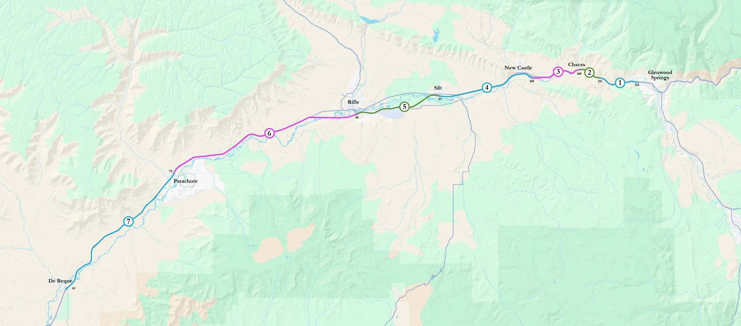
West Glenwood Springs to South Canyon (I-70 exit 114 to 111).
The trail throughout this segment will be adjacent to the south highway guardrail, on the north bank of the Colorado River. The first completed segment of trail connects with the Glenwood Springs Bike Route at the Mitchell Creek confluence. A second segment extends east from the historic bridge at South Canyon.
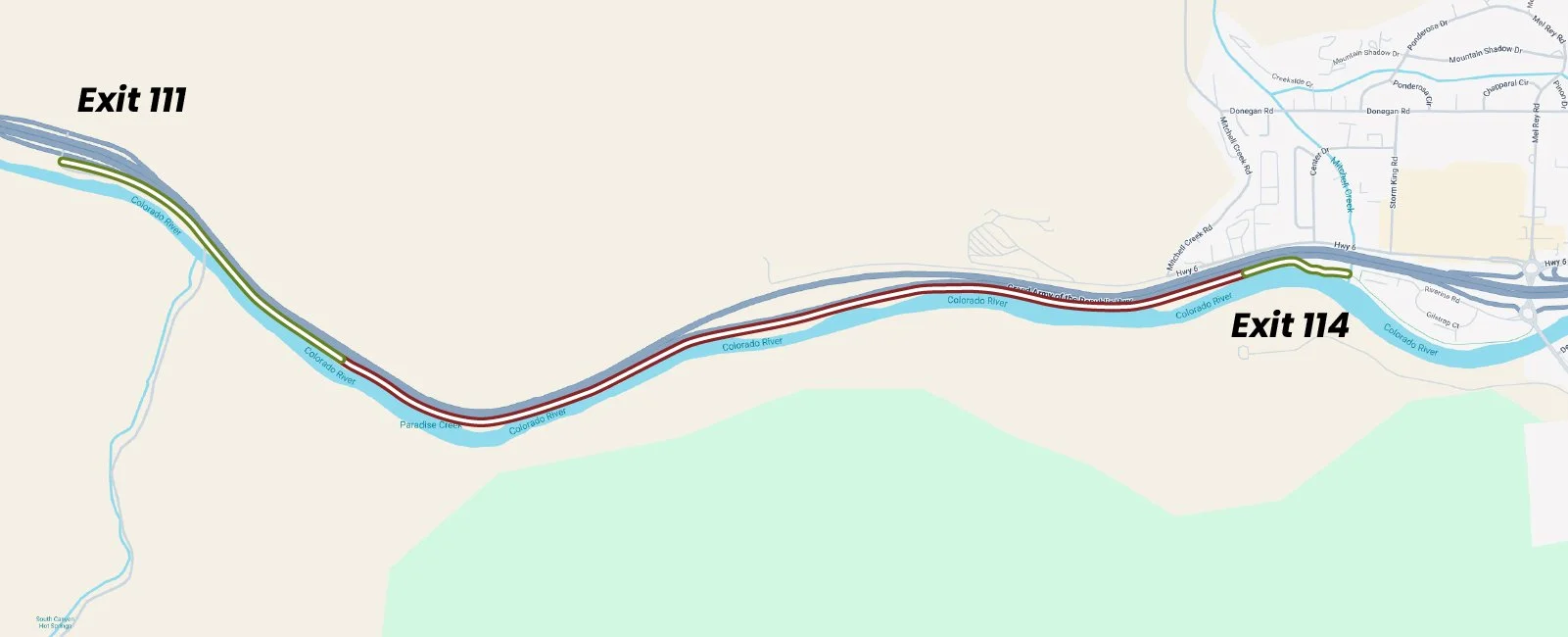
South Canyon to Canyon Creek (I-70 exit 111 to 109)
The trail throughout this segment will be adjacent to the south highway guardrail, on the north bank of the Colorado River.
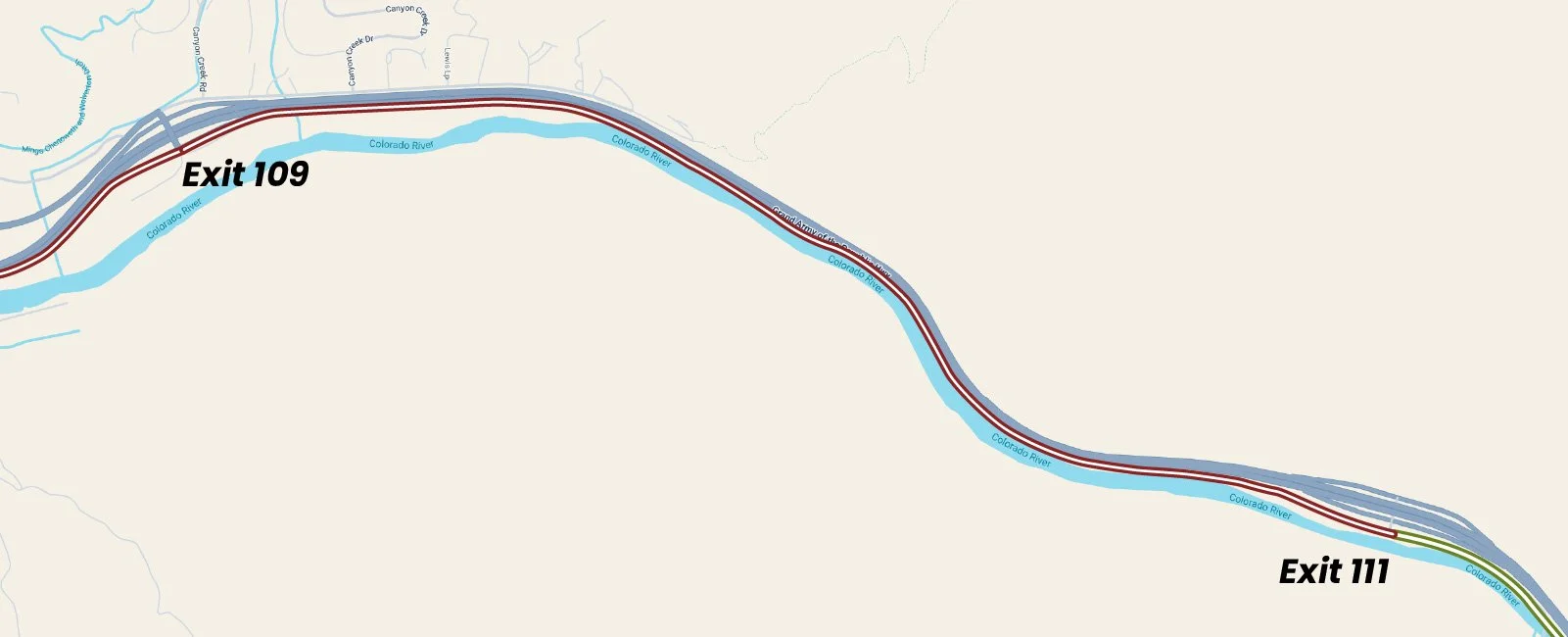
Canyon Creek to New Castle (I-70 exit 109 to 105)
The trail will thread through the Colorado Parks and Wildlife field office before crossing the river. It will then traverse an easement on Nutrient Farm to the west, connecting Riverbend subdivision with the River View condo community, along County Road 335.
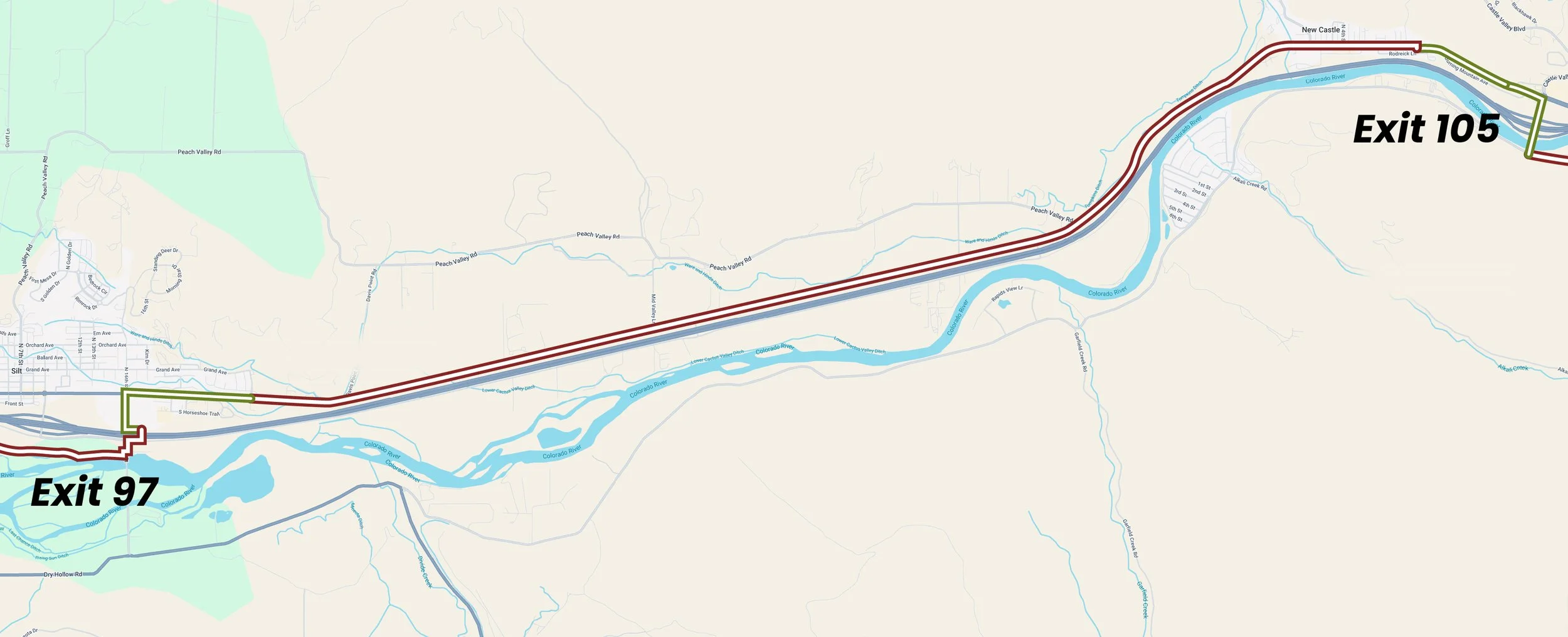
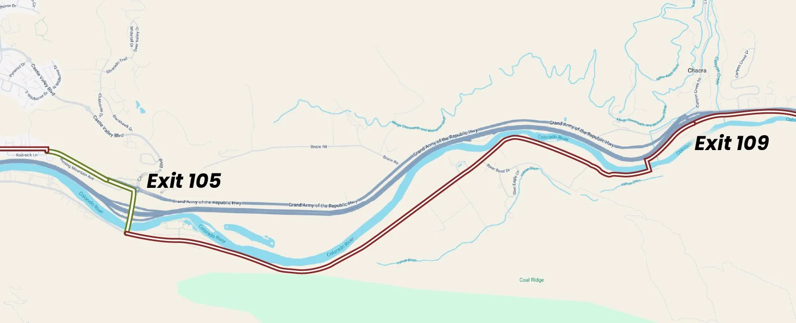
New Castle to Silt (I-70 exit 105 to 97)
Here the trail will connect the River View and Appletree communities with New Castle via the pedestrian bridge across the river, interstate and railroad, on the west side of the highway interchange.After passing through downtown New Castle, the trail will lie on the north side of Highway 6, connecting Coal Ridge High School with Silt. At S.16th Street there is a completed segment heading south and passing through a tunnel under I-70, connecting to Rislende and the Silt River Park.
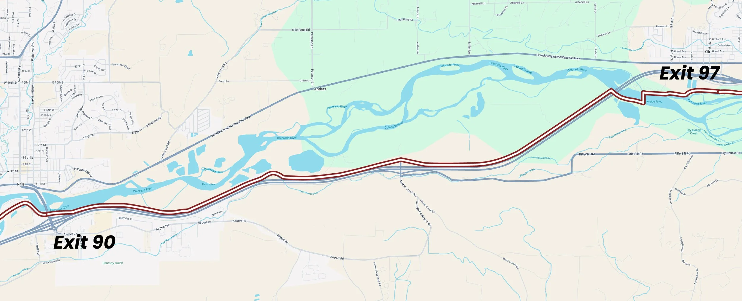
Silt to Rifle (I-70 exit 97 to 90)
The trail will traverse the communities of River Run and Heron's Nest along the north bank of the river. It will then cross the river and interstate again, connecting to county roads 346, 316 and then 315, coming out at Lion's Park Rest Area and the Rifle Boat Ramp.
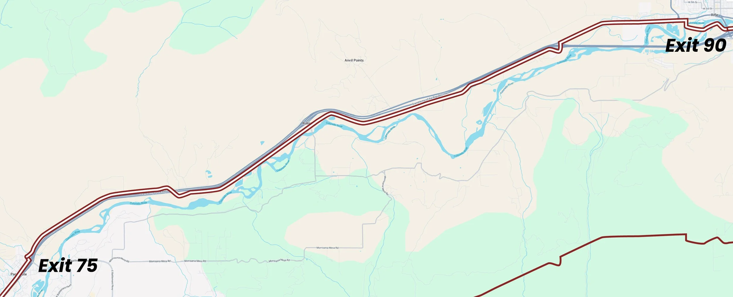
Rifle to Parachute (I-70 exit 90 to 75)
Here the trail will again go north across the river and railroad, threading through the Rifle Island complex and connecting with downtown Rifle. The trail will then go west along Highway 6, crossing the interstate to the south at the West Rifle interchange where it becomes the South Frontage Road. Just west of the Rulison interchange, the road crosses the interstate to the north again, following the North Frontage Road.
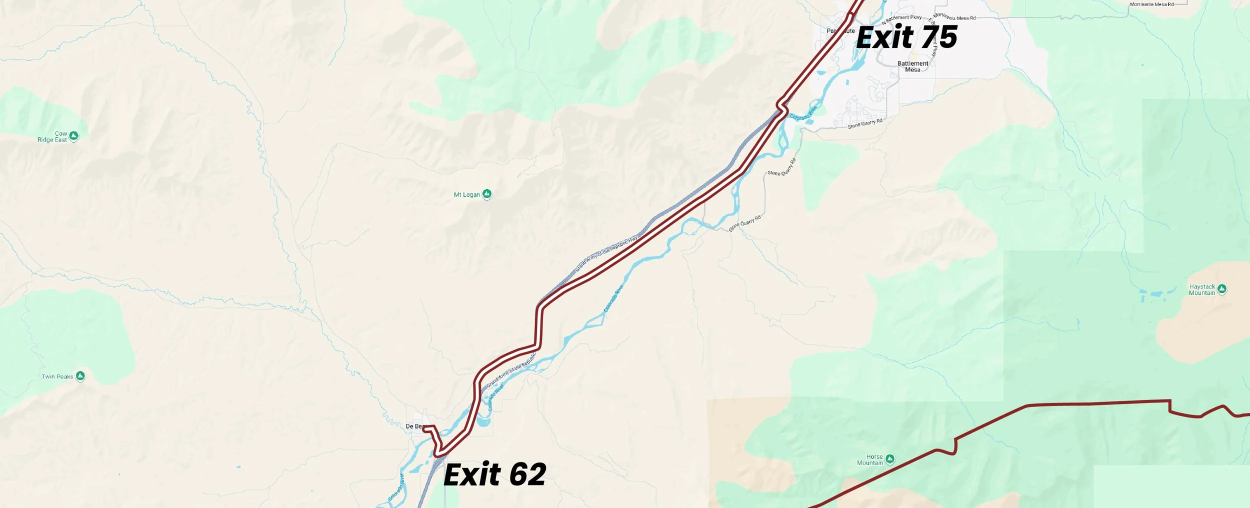
Parachute/Battlement Mesa to De Beque (I-70 exit 75 to 62)
The North Frontage Road becomes East First Street as it enters downtown Parachute, then West First Street, and then Old US Highway 6 to the west. It crosses over the interstate at the West Parachute exit, continuing on the south side of the highway toward De Beque. The trail along Old US Highway 6 crosses back to the north of the interstate one final time just west of the Garfield County line, connecting the communities of Parachute and Battlement Mesa with De Beque.